Quick Facts:
- AllTrails link: Salish Trail to Spanish Trail Loop, 7.2km with 103m elevation
- Difficulty: intermediate but only due to length
- Traffic: moderate
- Facilities: flush toilet at trail head, pit toilet at the information kiosk on 16th Ave
- View: forests, creeks, canyon, golf course, wetland, and partially obstructed views of Burrard Inlet and Spanish Banks below a cliff
- Overall score: 6/10
We’ve written about Pacific Spirit Regional Park in the past, but the park is so big that we haven’t explored many parts of the extensive trail network yet. The Spanish to Salish Trail Lollipop Loop was one of these unexplored areas for us.
We found some time to rectify this with Baby Bro.

We started at our favorite Park Centre Parking Lot and started north on our familiar Cleveland Trail.

About 1.5km in, we came upon the lollipop portion of the hike. Salish Trail continues straight all the way down to Arcadia Beach, where as Spanish Trail turns right and descends into a wetland. Since we’ve done the Salish Trail to Arcadia Beach previously, we decided to turn right and do the loop counter-clockwise.

There was a small area of wetland at the bottom of University Golf Club, which was a protected wildlife habitat.


A sign on Spanish Trail described the damages from the November 2021 storm here, which fell many trees.


We turned left onto Pioneer Trail, which crosses the 4-lane, high speed limit Chancellor Blvd with no traffic controls. It was a little sketchy to cross this with cars driving by up to 80km/h.


We crossed safely and continued our hike. We took the West Canyon Trail, which as its name suggests travels on the west side of Canyon Creek. The creek was well hidden under foliage though, so don’t expect to see much creek view.

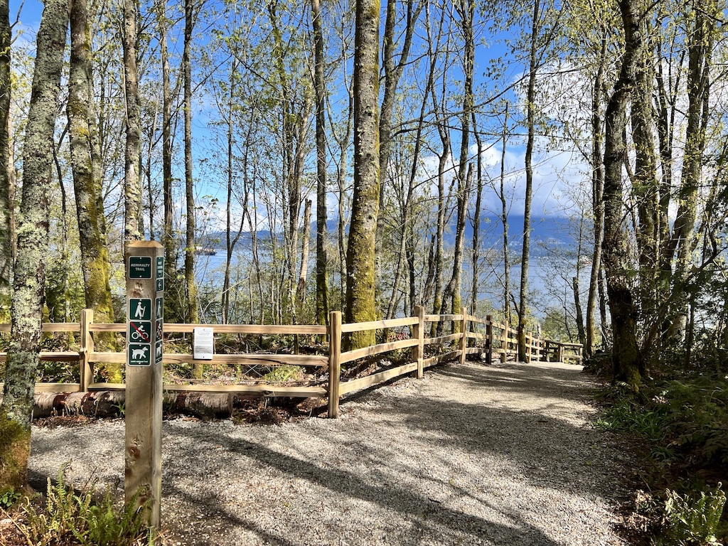
The West Canyon Trail gently descends as we walked north, until we arrived at Admiralty Trail.

A sign explained that due to erosion, portion of the Admiralty Trail had to be re-routed away from a steep and unstable cliff which already saw a number of debris slides.

As a result of the re-routing, the new trail was straight and almost shiny.

From what the topographical map showed, the old Admiralty Trail hugged the steep cliff very closely. I wonder if it presented a better view of the Burrard Inlet and Spanish Banks below.


As soon as we finished the re-routed section, we got onto the old Admiralty Trail which was very muddy and rooty. This was the only section of the whole loop that was stroller inaccessible. Up to this point, the trail was surfaced with gravel and quite doable with a stroller.


There was some construction on NW Marine Drive, so we didn’t bother looking for a way to get down to Arcadia Beach. It would have been another jay-walk style crossing on NW Marine Drive to the Arcadia Beach parking lot, and an easy descent onto the rocky beach.


Instead, we turned south onto Salish Trail, and did the only significant uphill climb of the whole loop (elevation 50m over 500m, or 10% grade). This got our heart rate and respiratory rate up for a few minutes, and this could pose a challenge for a stroller.
Salish Trail winds through the most unhealthy-looking area of Pacific Spirit Park. A blogpost noted that “The northern edge [of Pacific Spirit Park] was cleared in the 1920’s and then again in 1951 for housing that never occurred. The forest and its soils here were mangled badly. When left to regrow, the legacies of those impacts have persisted.”

This 7.2km loop took us exactly 2 hours. There was nothing too difficult or challenging on this loop. In fact, 90% of it was doable with a stroller. The 10% where a stroller might have issues is the muddy Admiralty Trail and steeper descent/ascents on the northern end of Salish Trail. The length of the loop would make it hard for our preschooler to finish though, so we will rate this as moderate.

