Returning to Stave Lake
Since visiting Stave Lake in 2020 with a SUP group, I haven’t been back. The experience was rather underwhelming: a bumpy, dusty gravel forest service road, loud motor boats and party music, and the dirt bike and ATV crowds at the lower Stave Lake weren’t very conducive for the type of adventure or leisure paddle that I like.
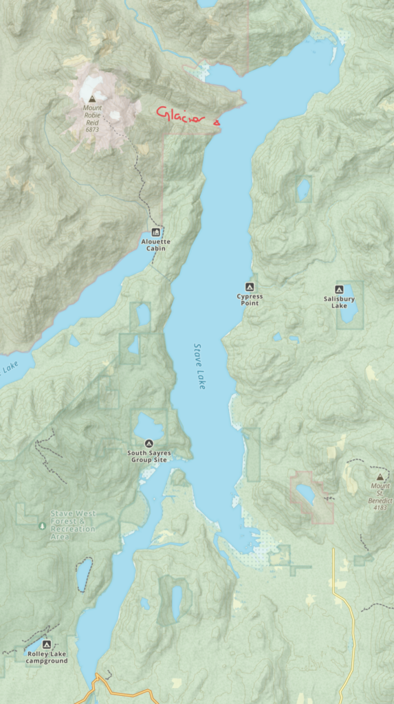
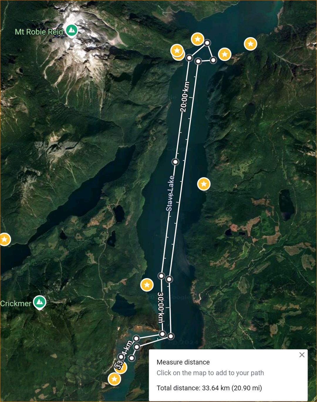
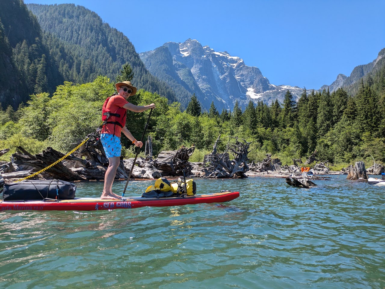
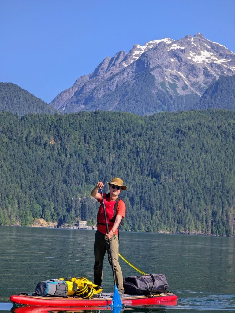
However, when Howard called for a paddle camping trip to a magical beach in the remote upper Stave Lake, right under the majestic glaciers of Mt. Robie Reid, I could not resist. He aptly described it as being similar to paddling to Granite Falls in terms of distance (approx. 18km depending on launch point), geography (long, narrow lake flanked by mountains), and thermal winds, but it ends with an epic view of glaciers. It’s even complete with its own power house.
Stave Lake can be divided into two lobes at Rocky Point. The western (lower) lobe to the south west of Rocky Point is 21km in circumference. The public boat launch is at the southern tip of this lobe, so are most of the popular rec sites, so this is by far busier. The larger upper lobe to the east of Rocky Point is 54km in circumference, and it’s much less populated and more rugged. Glacier Bay lies close to the northern end of this larger eastern lobe.
Water level in Stave Lake was artificially raised when a dam was built for power generation, so there are many tree stumps and deadheads along the beaches. This also means the water level here is dependent on rain fall, snow melt, and most importantly, BC Hydro operations. Overnight fluctuations as much as 6 feet have been reported in times of heavy rainfall and rapid snow melt.
The Paddle Plan
Howard assembled a group of 7 paddlers and did a scouting trip for us. The most ‘proper’ parking options are Kearsley and Rocky Point Recreation Sites, where paddlers could pay $10/night for parking if they have space. However, if they are full, one can risk parking along the Forest Service Road which runs close to Stave Lake between Rocky Point and Kearsley. Park at your own risk though, as there are many signs that prohibit overnight camping along the road. To minimize our parking space usage, we would carpool in 2 cars with enough clearance for the bumpy FSR.
Day One
- 5:30am wake up
- 6:00am Leave home
- 6:25am meet up with driver
- 6:30am carpool depart
- 7:30am arrive at Stave Lake FRS mile zero: https://maps.app.goo.gl/HUPtY6toJk5LkYPu5, for the 2 cars to meet up before leaving cellphone range (actual time: 7:40am)
- 8:00am drive up to parking/launch point.
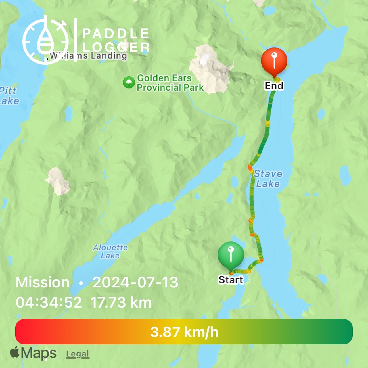
- 8:30am Prepped and launch. Paddling north towards Glacier Bay. (9:00am)
- Distance: 14 to 18km depending on where we end up parking
- Estimated paddling time 4 to 5 hours
- Possibly stopping for lunch?
- 2-3pm Arrive at Glacier Bay. (1:30pm)
Possible camping spots:
Relax, set up camp, and enjoy
Day Two
- 5:30am wake up (5:00am)
- 6:00am breakfast and coffee
- 7:00am take down camp (6:30am)
- 7:30am launch.
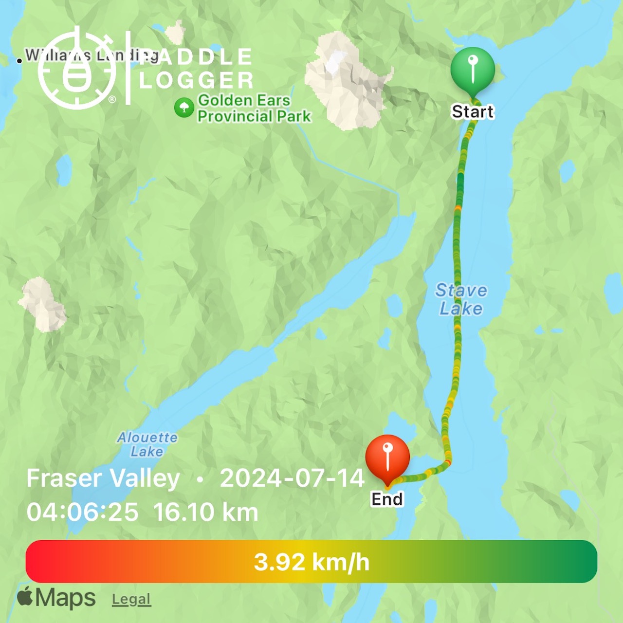
- Headwind may be a factor, estimated paddling time 6-7 hours
- 2-3pm Arrive at Rocky Point (11:40am)
- 4pm Should be back in cell phone range (12:40pm)
- 6pm back to drivers’ place (1:30pm)
- 7pm back home (2:15pm)
The Journey
The water level in Stave was very high on this trip. The sandbars where people held large ATVs parties were flooded, so it was much quieter.
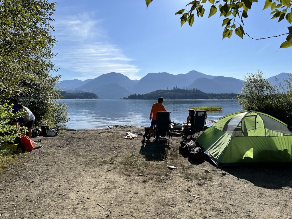
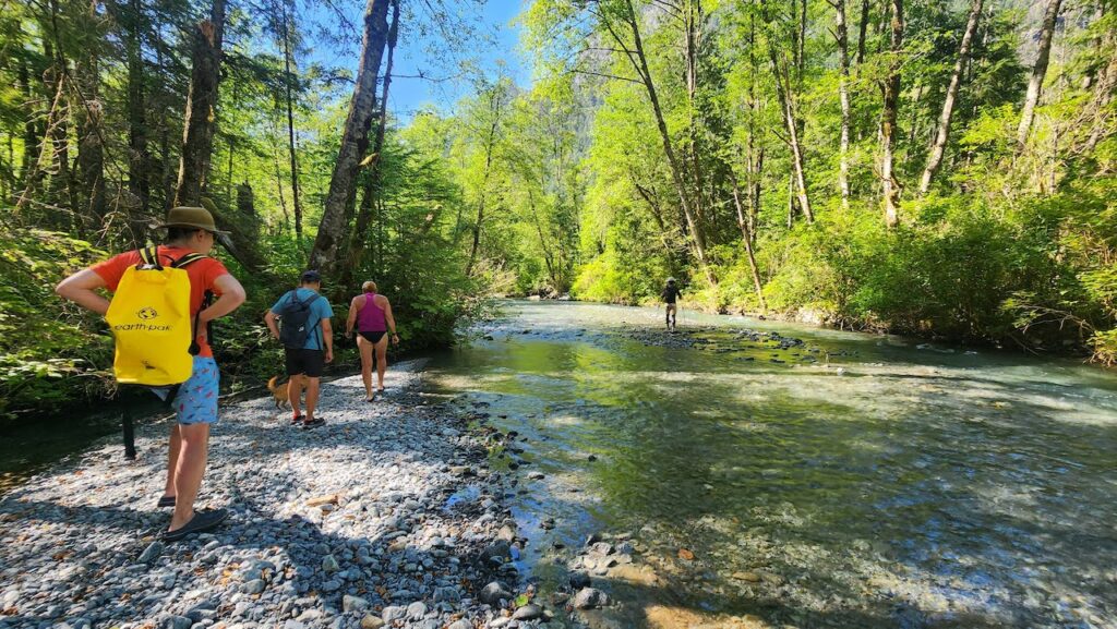
As it turned out, Rocky Point Rec Site was full and the camp host turned us around. We arrived to our backup parking spot along the FRS.
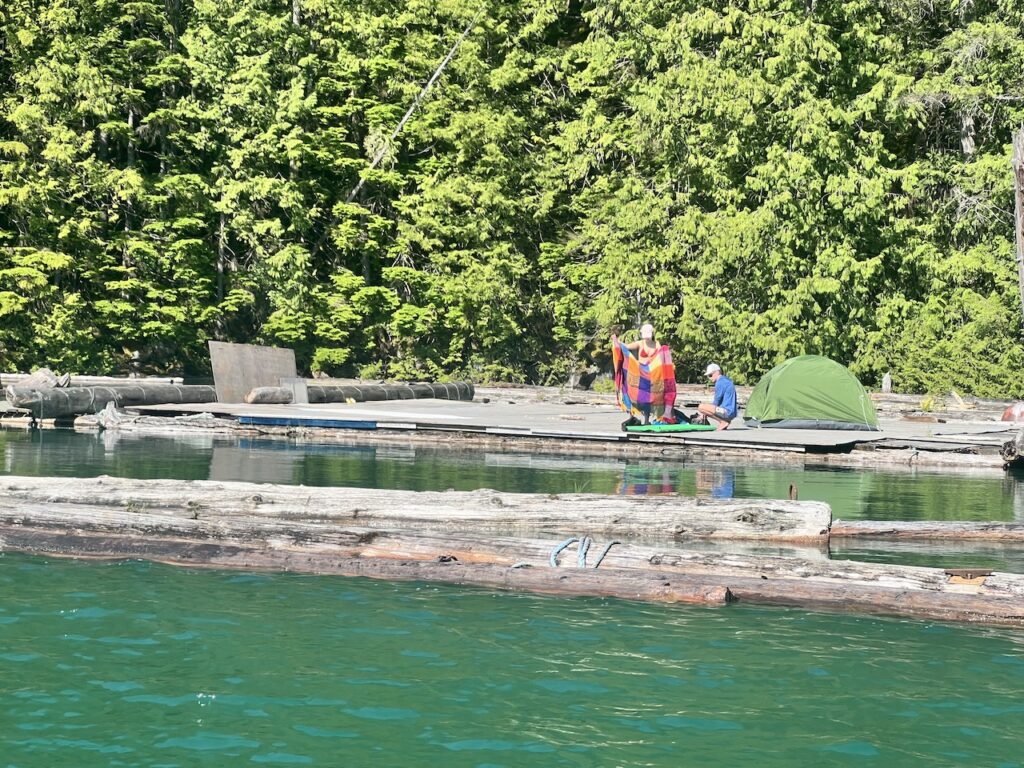
There were campers on the small beach near our launch spot, and we had to go around their tent. The campers were not obstructive, probably because they were sheepish about camping there as well. After all, it’s unsanctioned crown land camping, but the rec site operators don’t seem to take issue.
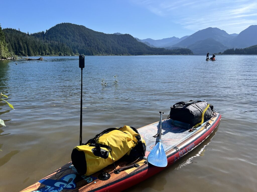
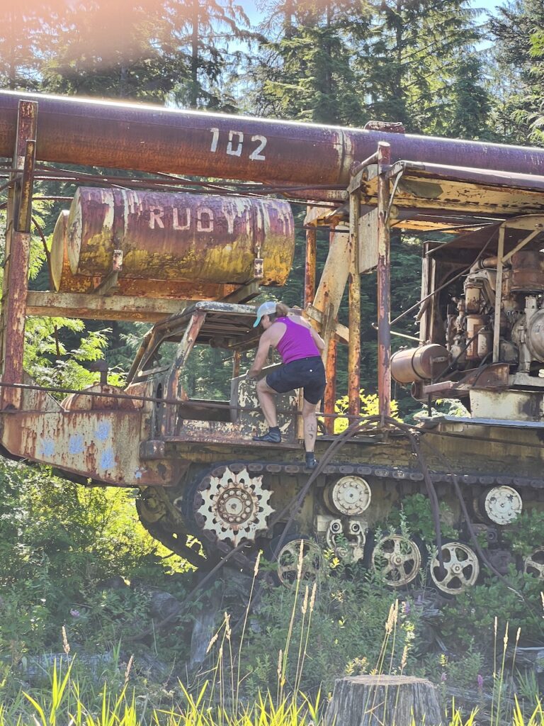
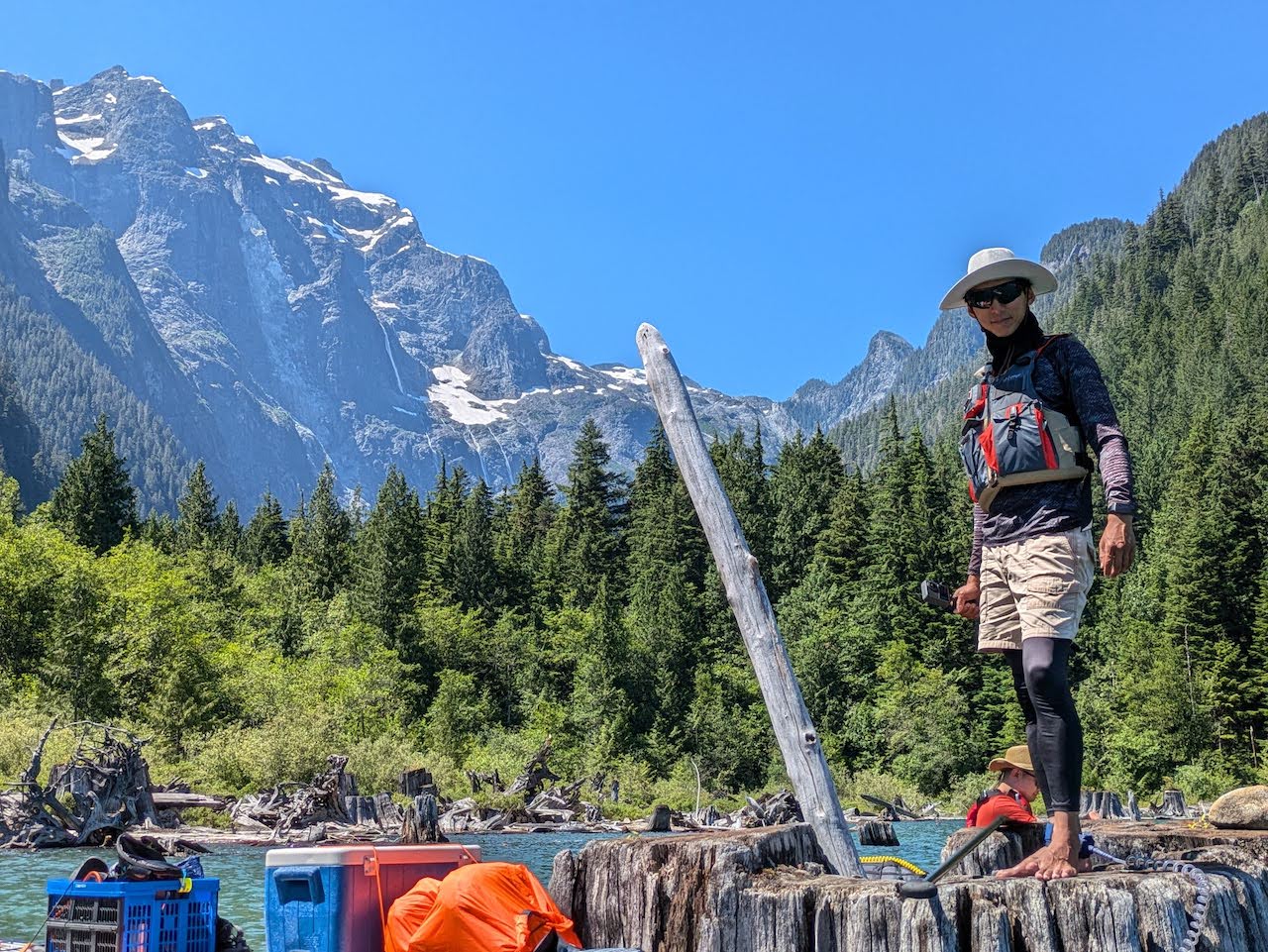
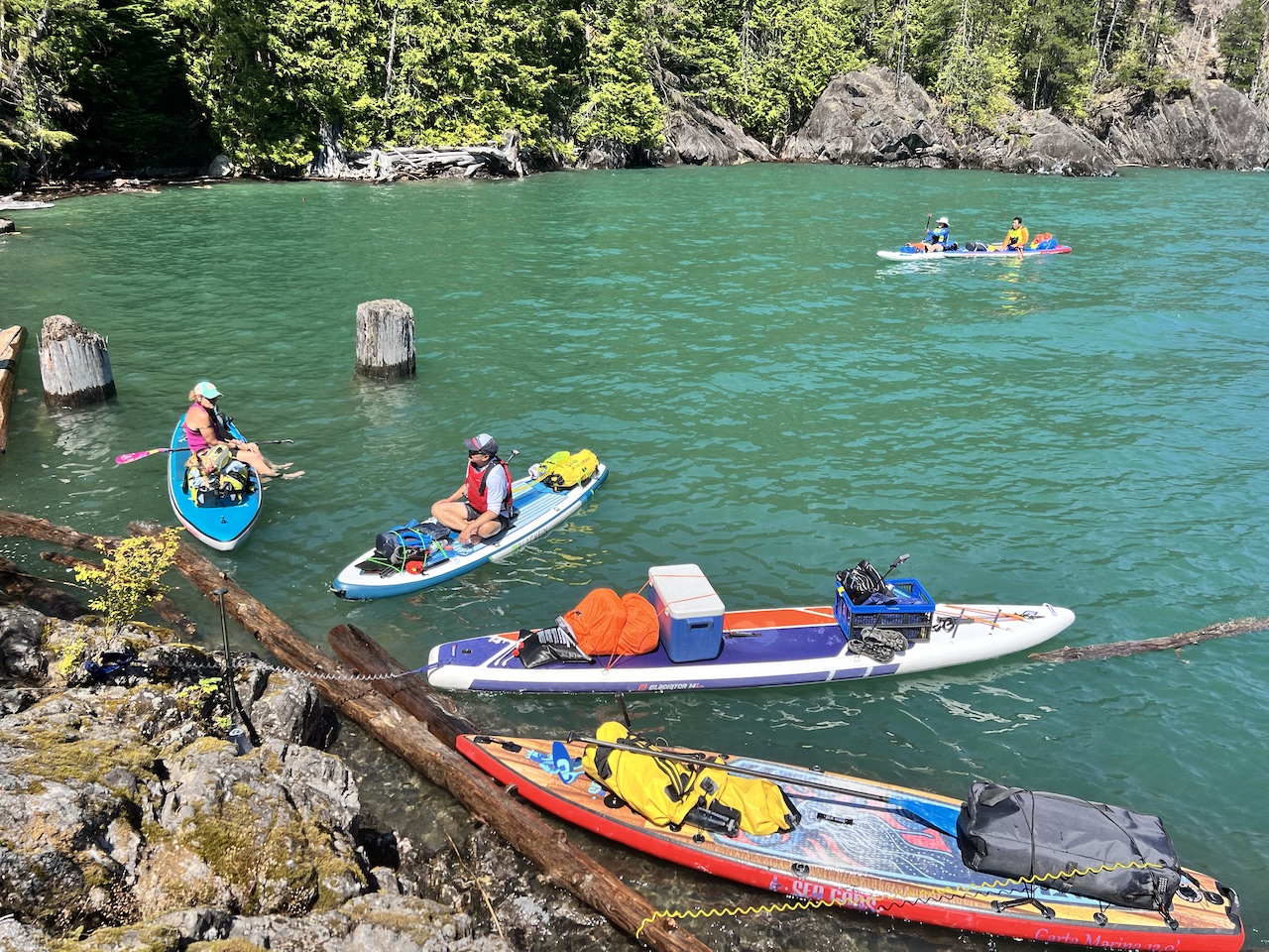
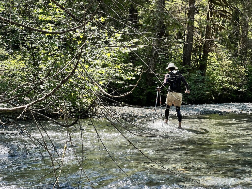
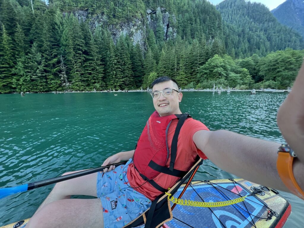
Pumping and loading took about 1 hour, and the group was on the water around 9am. We hopped over to the eastern shore of the lower lobe and explored an abandoned crane, likely used for logging.
We hopped back and rounded Rocky Point. Almost immediately afterwards, we came upon a floating platform that someone built, and where was a couple camping on it! It would make an interesting experience to camp right on a wobbling makeshift barge.
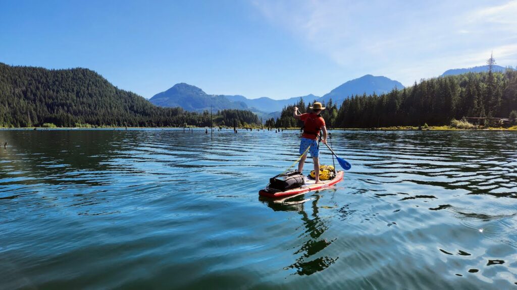
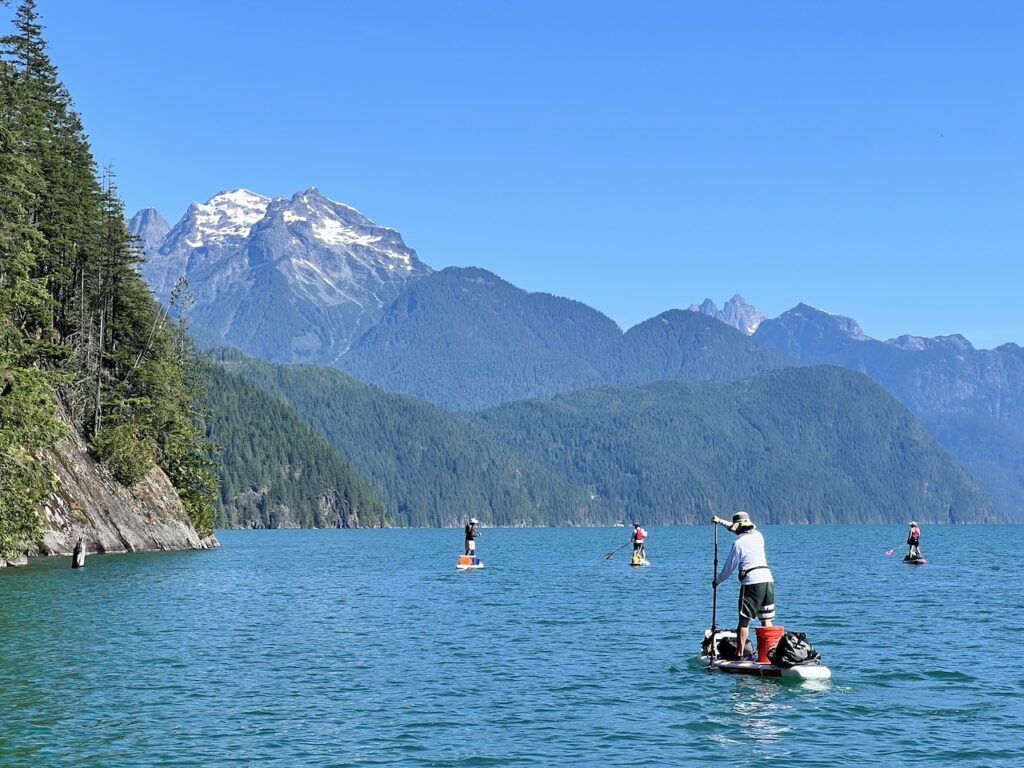
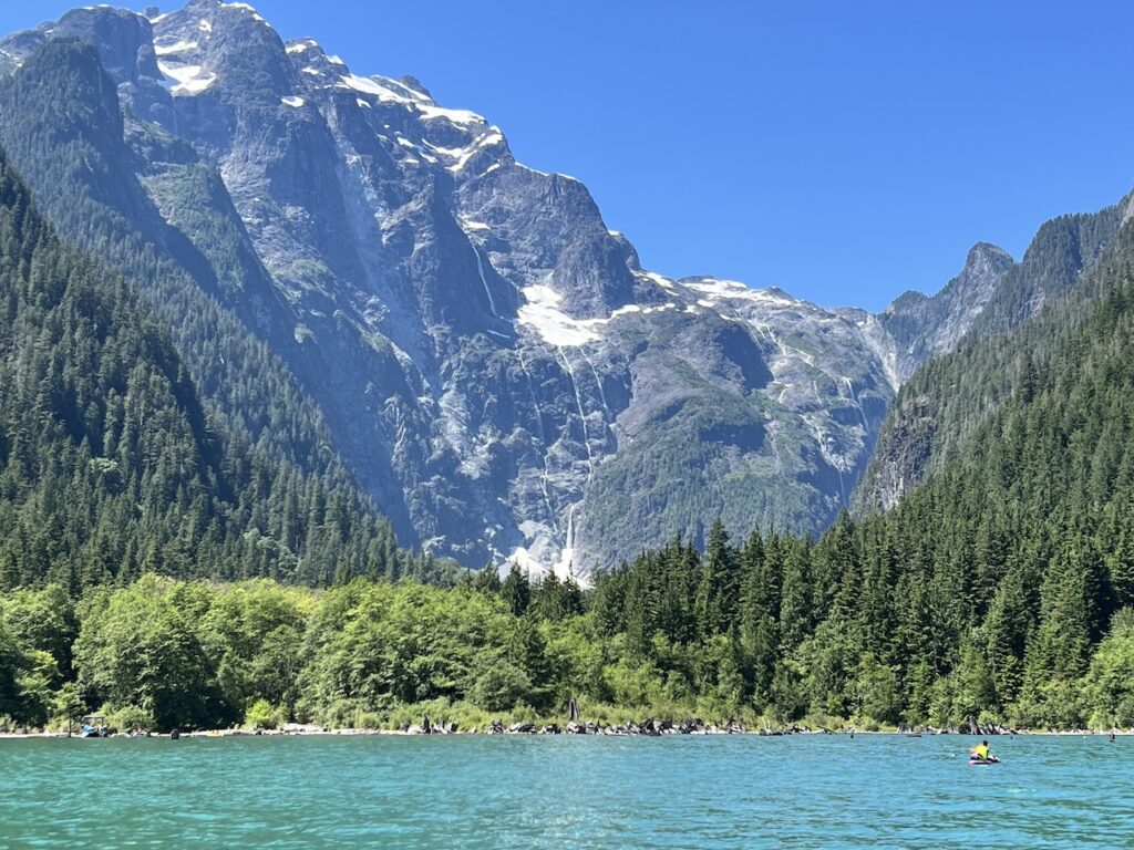
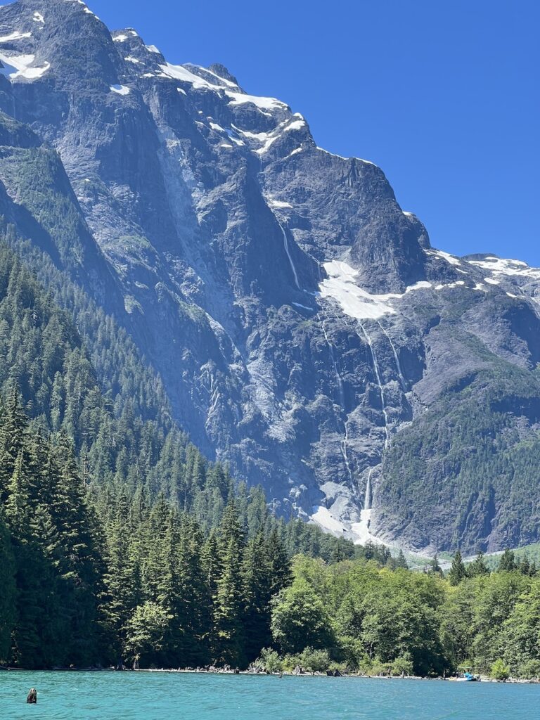
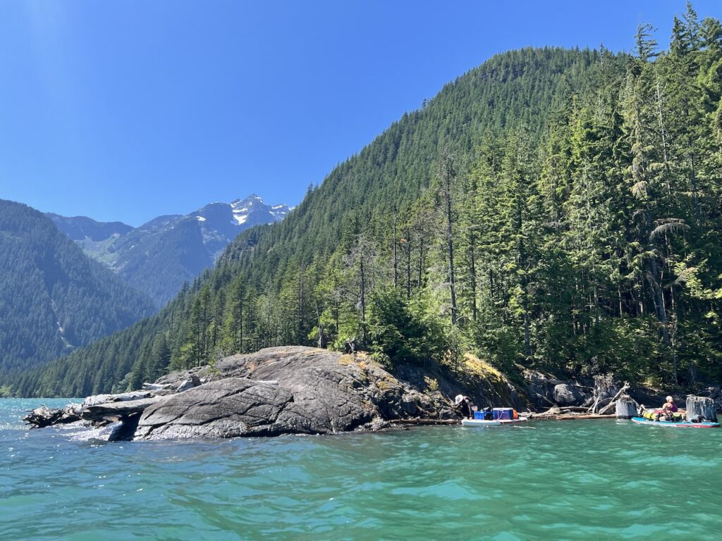
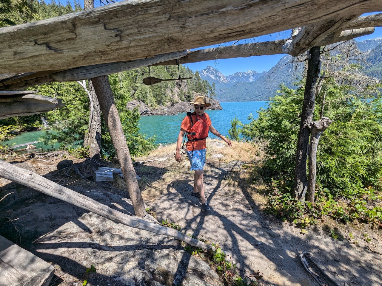
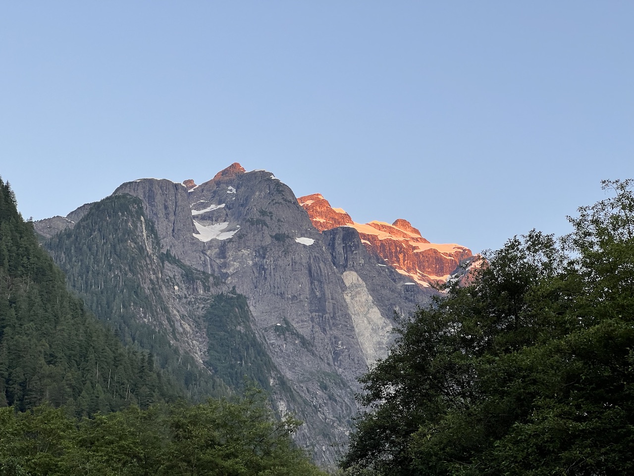
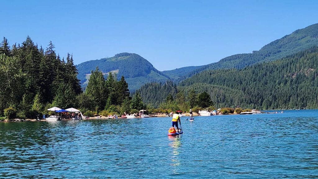
As we paddled past some cliffs, our view opened up like a curtain and revealed the snow-capped Mt Robie Reid.
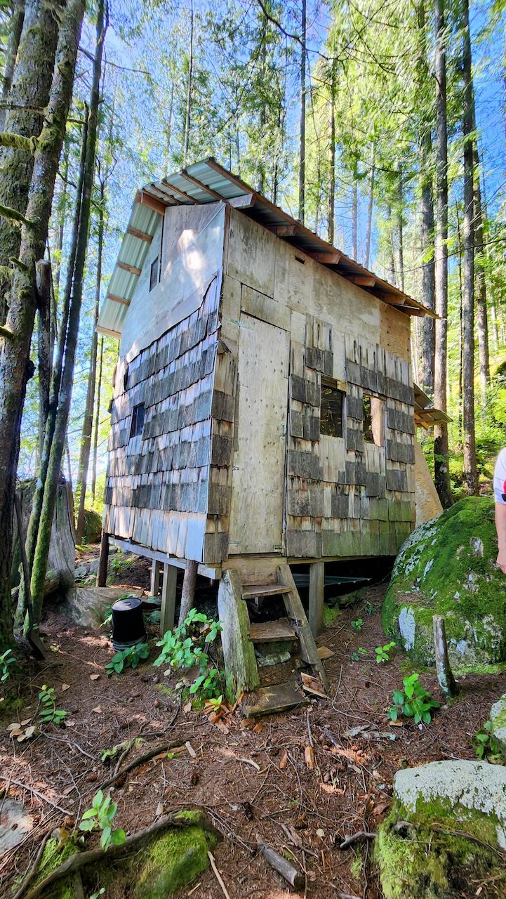
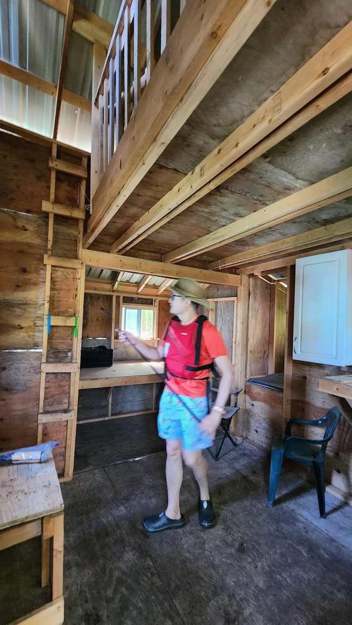
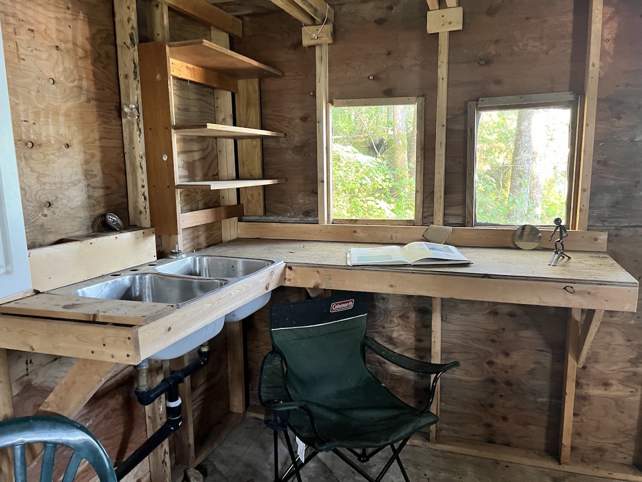
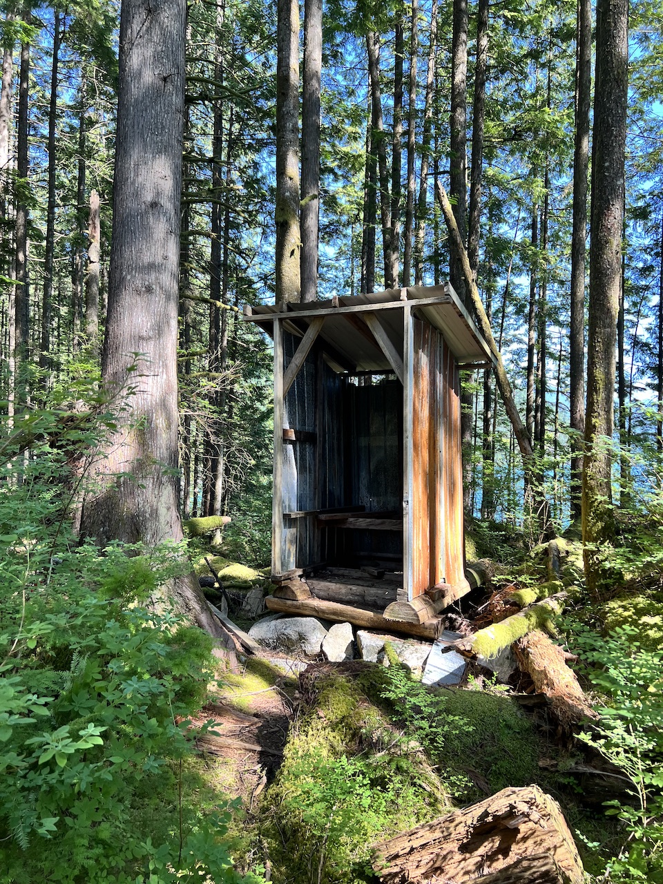
We took our time to explore the western shore. Soon we arrived at one of the many cabins on the lake that are open for public use, with an outhouse in the back. The cabin was well built, likely by actual trades people with proper skills, materials, and equipment, since it even has a 2nd floor.
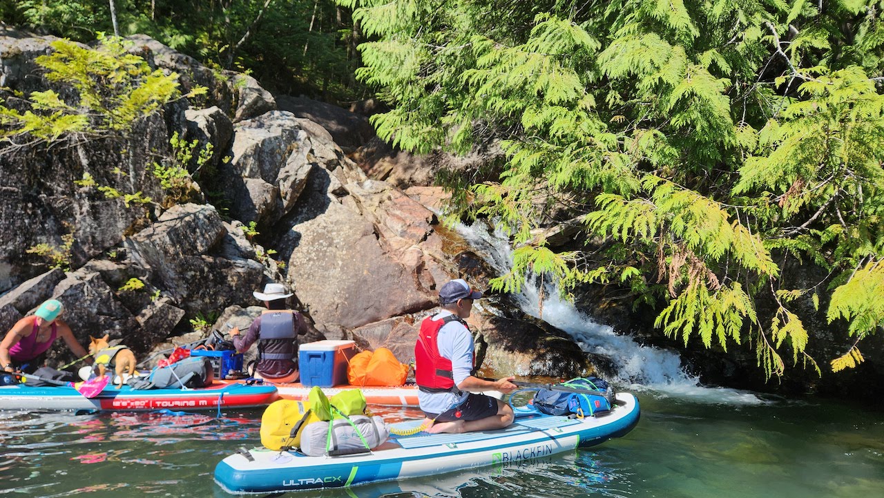
We also stopped at a waterfall and had a snack break at the power generator. It’s much smaller than the one in Indian Arm, but when BC Hydro decides to open the flood gate, there can be an ‘explosive waterfall’ as Howard put it. It was only a trickle when we were there though.
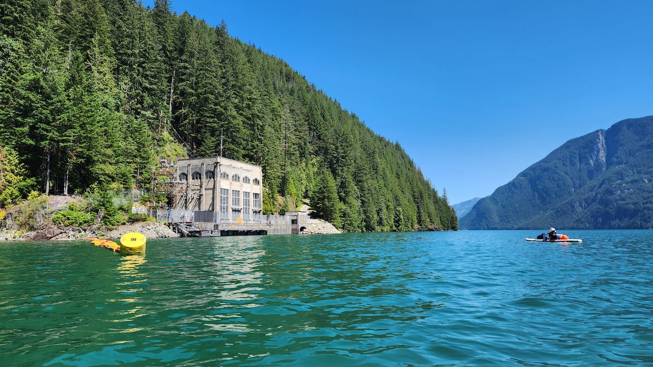
The generator marked the halfway mark to Glacier Bay, so we pushed on.
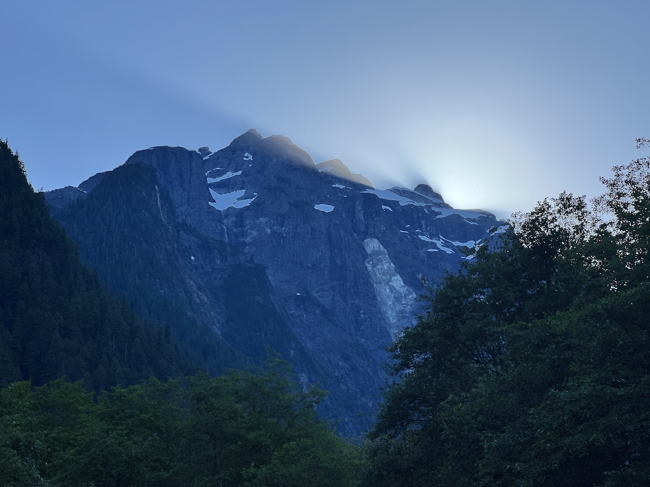
After rounding a final corner as we approached Glacier Bay, our jaws dropped. The dominating presence of Mt Robie Reid was stunning. We slowed down our paddling to marvel at its beauty. I tried to think of a view as grand as this on a local paddling location, and I came up empty.
There were some friendly boaters at the rocky beach. The high water level meant that large sandy areas were flooded, so area suitable for camping was limited. Thankfully the boaters were only there for a short stop. One guy told us he explored every beach on Stave Lake, and there were many hidden gems to find, including one grand cabin with a porch and glass doors. A 4-5 day, careful circumnavigation of Stave Lake may be in order.
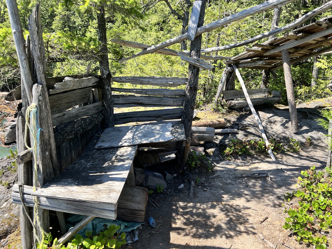
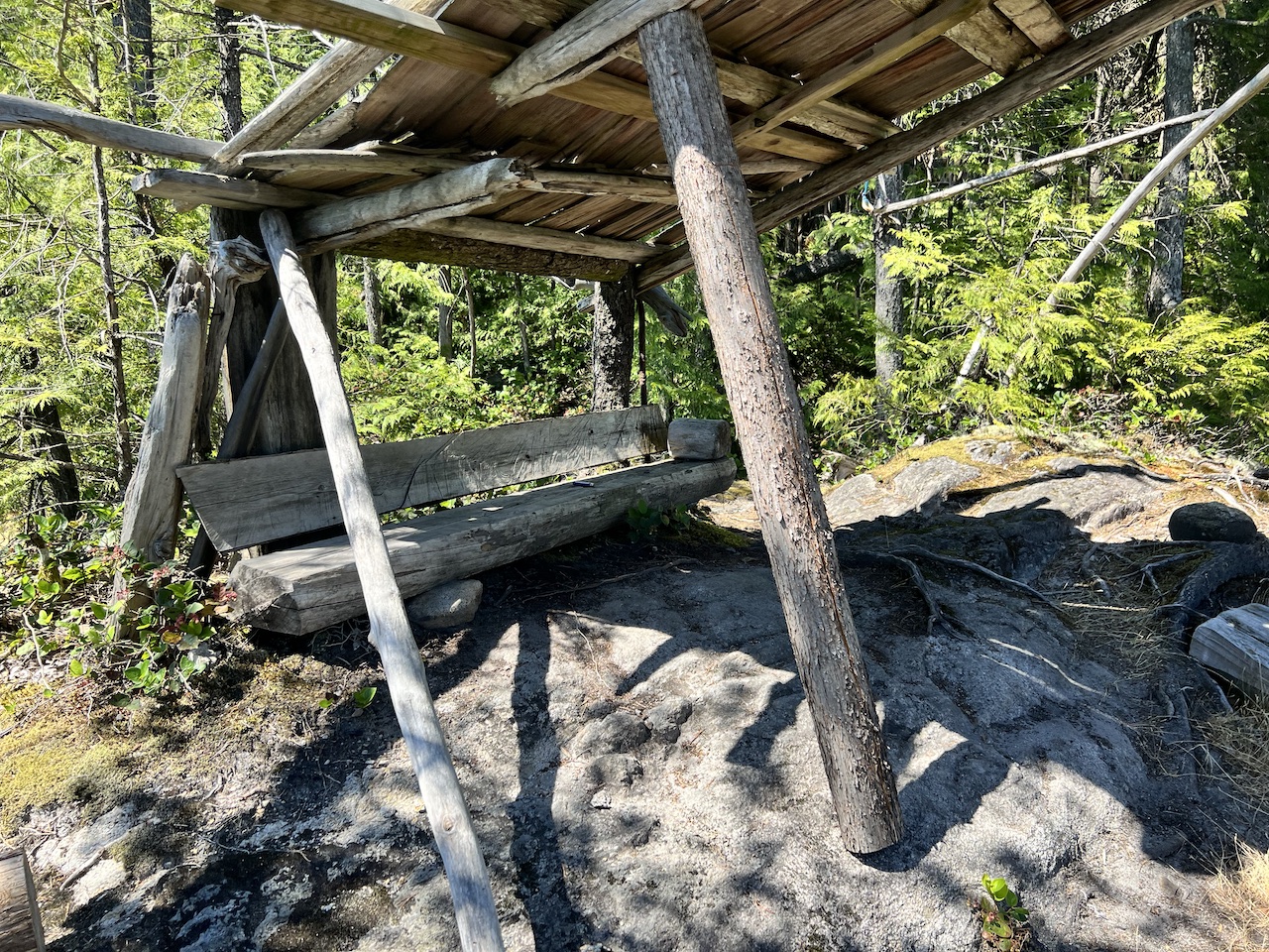
We thought there may be more room at Cottage Point, since the map shows it as a designated marine campsite and a part of Gold Ears Provincial Park. We envisioned something like the marine campsites of Granite Falls.
It turned out that it’s almost impossible to land at Cottage Point, and it’s little more than a shed and some benches built out of drift wood. There’s barely enough room for one small tent on this rocky outcrop.
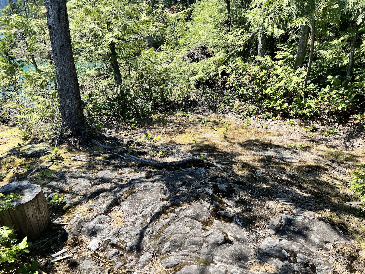
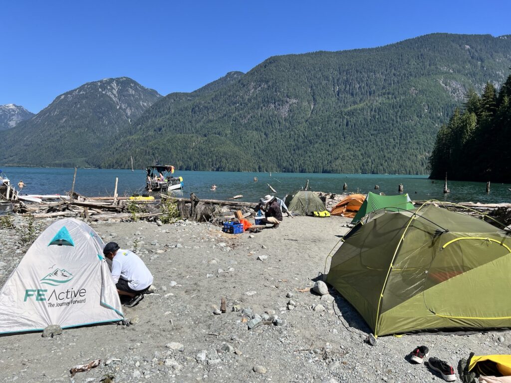
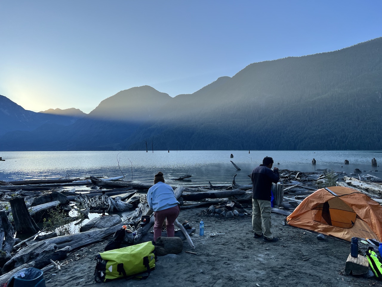
We returned to Glacier Bay and set up camp. There was just enough sandy beach for our group on the shore. I wanted to be a little further away from the water and be among trees for the shade, but I was being eaten alive by black flies so I quickly changed my mind.

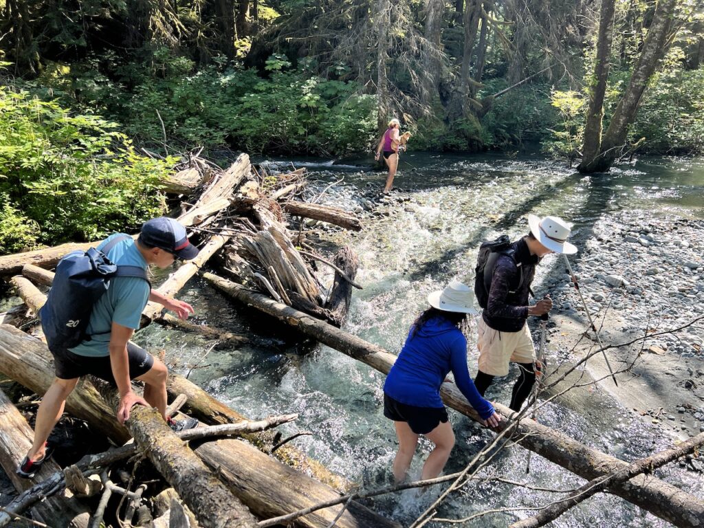
After we took some time to settle down and stretch out our tired arms, Howard led a small expedition to trace a glacier-fed creek. During times of lower water, one could hike up the dry creek bed to explore the glaciers at the foot of Mt Robie Reid. But we were soon thwarted by the bone-chilling, fast flowing creek. The sustained heat wave was surely doing a number on the glaciers!
We came back for a nice dinner. Camp fire ban was in effect, so we did not start one.
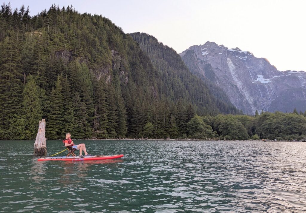
As a major perk of paddle camping, we could paddle whenever we want. Howard went out for a float around the bay on his camp chair, which looked awesome. So I copied him.
After a few games of Uno and constant laughter, the group turned in for bed. The plan was to get up bright and early to launch at sun rise. We wanted to beat the expected southerly headwind that will get powerful near noon.
I camped without my rain fly, as I like to do when the overnight low is above 15oC. Deep into the night, I remembered to put on my glasses and gazed at the blanket of stars.

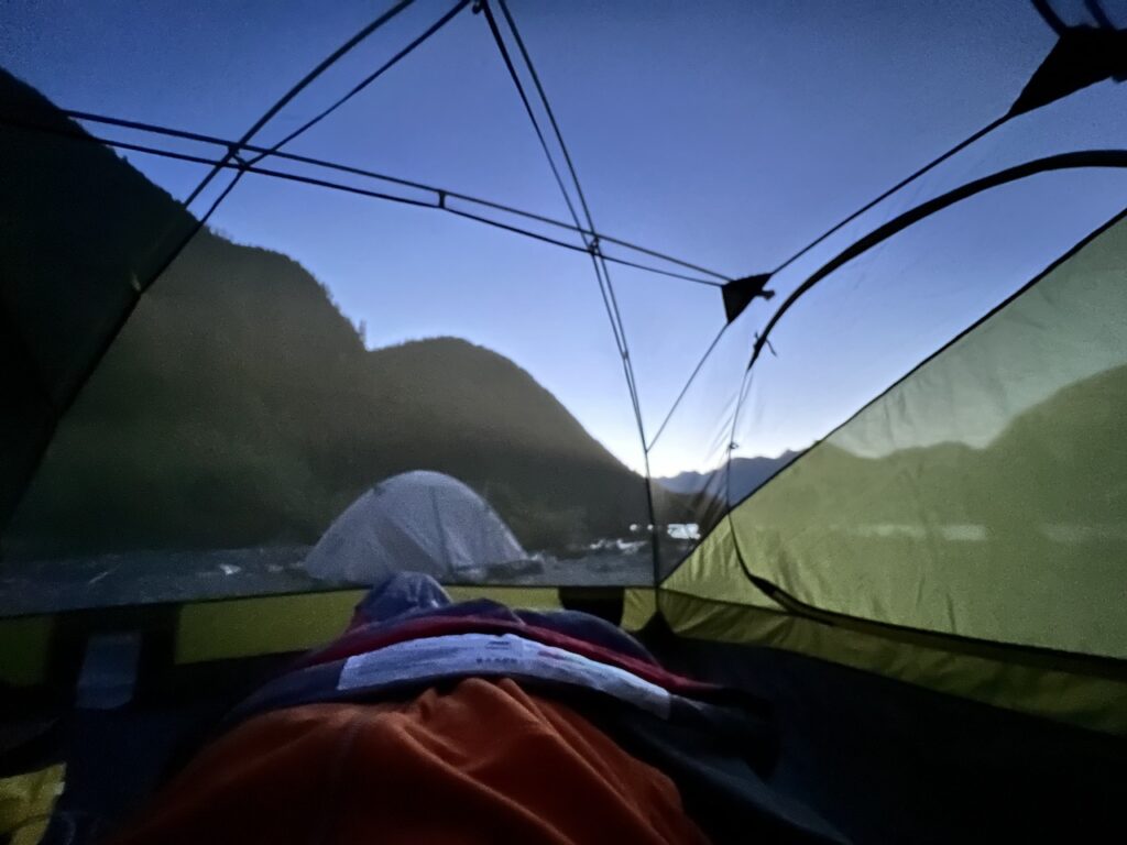
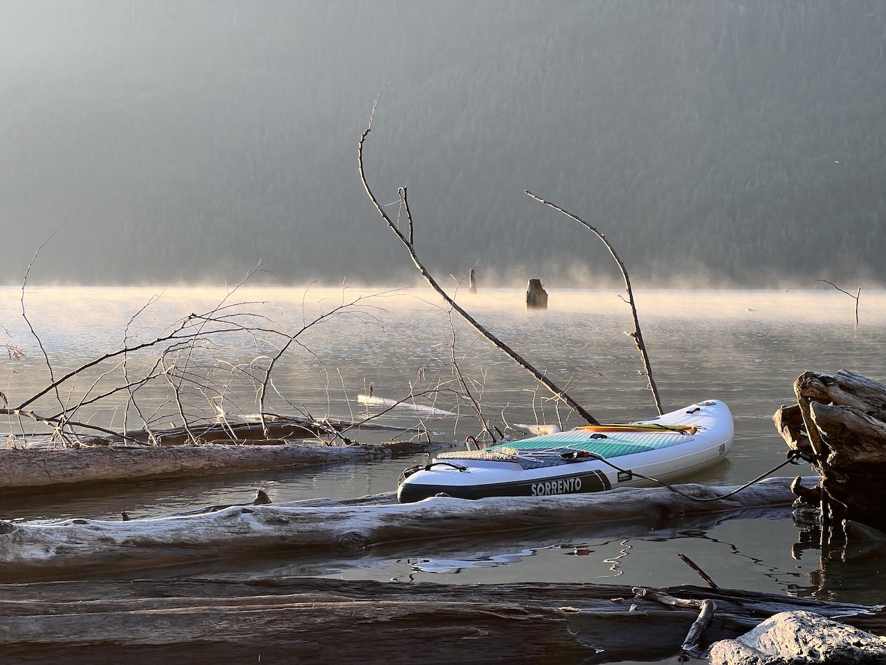
I got up at the first morning light before 5am. That’s my camping routine, which allows me to enjoy the absolute bliss of morning in nature: crisp, chill air, silence punctuated with bird calls, and a cup of hot coffee. A beautiful 2-3 hours before the kids get up.
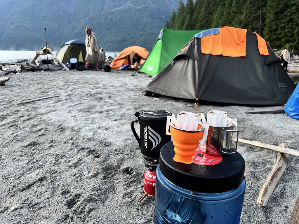
But we didn’t have 2-3 hours to enjoy this morning. The group soon got up as planned, and we efficiently finished breakfast and packed. The sun rose but was hidden behind the eastern mountains, so only the glaciers on Mt Robie Reid turned orange at first before the sun finally peeked through.
“Where’s my board?” A group member suddenly asked. Since the landing was a little awkward over some floating logs, many of us simply tied up our boards to the biggest tree stump we could find. A better idea was to move the board onto shore, and tuck them under good tree shade. This member did the right thing first, but then moved her board back onto the water in order to launch as early as possible in the morning. It must have gotten loose and floated away!
We sent out scouting parties and combed the nearby shores for a good 20 minutes, and came up empty. We made some quick decisions, and came up with a good plan: we redistributed the load among the 6 remaining paddlers, with Howard taking her on his board. It was a very good thing we came with a good group of strong paddlers. Had it been a trip with only one or two paddlers, we would have to call for rescue.
After about 20 minutes of paddling, a red object caught Howard’s eye in the distance. He went over to investigate. Remember: this lobe of Stave Lake is 54km in circumference, and the board had all night to drift whichever way the wind blew (and the wind changed directions, from a southerly wind last night, to a northerly this morning). The chance of us finding it was slim. We even preemptively messaged the local search and rescue team via satellite messaging not to worry if they find a loose board that fit the description.
As it turned out, the red object was just a random buoy. But to everyone’s astonishment, her board was lodged merely 10 meters away from it! I was dumbfounded. The mostly-neutral colored board completely blended into the shoreline and would not have been spotted had it not been right next to the big red buoy.
We tried to give a rational reason: perhaps the buoy was free floating too and become lodged in this particular area because of the geography or prevailing wind and wave pattern, which is also why the board stayed here. But in my mind, even if the two objects were released at the same time in the night, the chance of finding them side by side in the morning would be slim to none. Higher power at work? I looked at the print on my board: “Sea Gods” and found a new respect for mother nature.
After that little fright and pleasant surprise, the remaining paddle was uneventful. We made a b-line for the launch point because we all knew about the coming thermal winds. Thankfully, all was quite calm and the northerly wind helped us 2/3 of the way.

We briefly considered stopping at a party beach for a group lunch on the eastern shore of lower Stave Lake south of the abandon crane, but by the time we got to the northern tip of Stave Island where many boaters are camping right on the beach, the dreaded winds picked up around 11am.
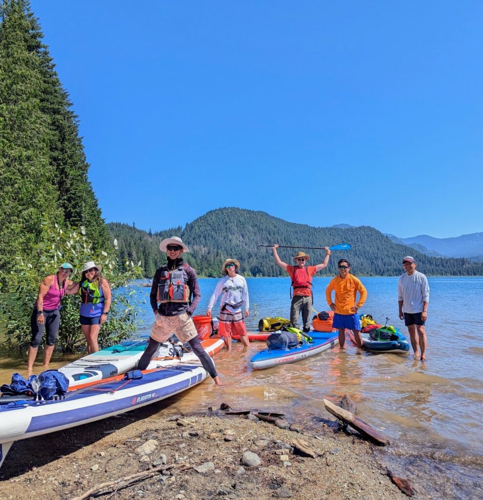
We abandoned our lunch plan and paddled across the lake, fighting a cross wind the whole way, and safely landed at 11:40am, a full 2.5 hours ahead of schedule.
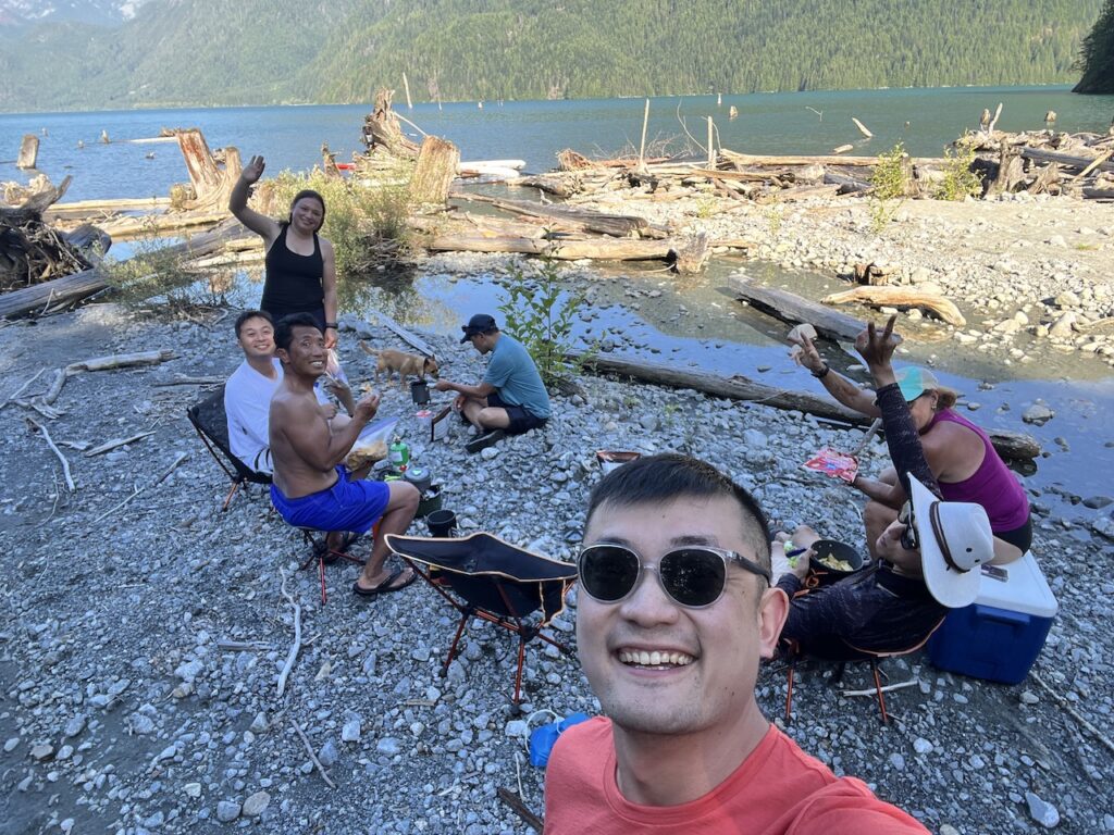
A different group of campers were at the beach, who again were kind enough to tolerate our disruption and even helped us with our victory group photo.
A few key lessons learned on this trip:
- Stave Lake can be a peaceful, serene place but one has to get out to the northern half of the lake, much like Indian Arm
- At high water level, camping areas shrink down considerably at Stave
- Glacier Bay and Cottage Point are essentially undeveloped back country camping, with no toilet facility. We drank filtered or boiled glacial melt creek water, which was delicious
- Get the boards off the water if at all possible. If not feasible (such as camping at Cottage Point where one basically has to scramble off the board onto the point), tie it to a secure location. In hind sight, I could have lost my board too since I used my quick release river leash to tie the board.
- Solo paddles can be meditative, but paddling with like-minded friends is not only more fun, it’s also a lot safer.
Paddle logs: